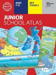
Philip's RGS Junior School Atlas New

- Format
- Paperback
- usd prices
-
Save $1.39Offer price: $12.45 Switch to £
- RRP: $13.84
- gbp prices
-
Save £0.89Offer price: £8.10 Switch to $
- RRP: £8.99
Buy this and your school gets $2.49 to spend on books
This product has not been rated yet.
0 reviews (Add a review)

Delivery information
We are only able to deliver orders to school addresses
- FREE delivery for schools*
- Delivery within 10 working days
Book Club orders
- FREE delivery to schools
- Books will be despatched after the school's order is confirmed
*We do not charge for delivery, but your order may incur additional customs costs.
More books for 7 - 11 year olds
Categories
Product description
The 12th edition of the market-leading atlas for primary school pupils, Philip’s RGS Junior School Atlas has been fully revised and updated with all the latest facts and curriculum requirements.
- The essential atlas for primary schools with clear and easy-to-follow maps and diagrams – updated for 2024/2025 - Published in association with the Royal Geographical Society - Recommended for Key Stage 2 of the National Curriculum – and all 7-11 year olds - An excellent introduction to mapping concepts such as scale, direction, symbols, longitude and latitude - 22-page Britain and Ireland section with clear thematic charts, diagrams and large-scale regional maps - 22-page section on The World, with political maps – and thematic treatment of key themes, from volcanoes and earthquakes to transport and tourism - Continents section with physical and political maps - Easy-to-follow map references and 1,000-place index
The introductory section describes the meaning of scale, how to measure distances using the maps, and explains the symbols on the maps.
The following section is devoted to the United Kingdom and Ireland. Thematic maps cover topics such as mountains and rivers, climate and weather, population and cities, farming and fishing, industry and energy, transport, tourism and conservation.
The rest of the atlas is made up of world thematic maps and world continental maps. Included are topics such as the world’s climate, vegetation, agriculture, energy sources, and environmental concerns, such as global warming. A simple letter-figure index completes the atlas. Available in both Hardback and Paperback editions.
Product Details
Catalogue number
4035 in Rewards Catalogue 2024/25
Format
Paperback
ISBN
9781849076890
Publisher
Date published
September 12th, 2024
Other details
- 64 pages
Condition
New
Available in these packs
-

30copies
Philip's Junior Sch Atlas x30New
- usd prices
- Offer price: $352.95
- RRP: $415.34
- gbp prices
- Offer price: £229.20
- RRP: £269.70
-
6copies
Philip's Junior Sch Atlas x6New
- usd prices
- Offer price: $74.70
- RRP: $83.07
- gbp prices
- Offer price: £48.50
- RRP: £53.94

Reviews
This product has not been reviewed yet.
Add a review
Similar items
-
30copies
Philip's Infant Sch Atlas x30New
- usd prices
- Offer price: $352.95
- RRP: $415.34
- gbp prices
- Offer price: £229.20
- RRP: £269.70
-
30copies
Philip's Essential School Atlas x30New
- usd prices
- Offer price: $352.95
- RRP: $415.34
- gbp prices
- Offer price: £229.20
- RRP: £269.70
-
6copies
Philip's Infant Sch Atlas x6New
- usd prices
- Offer price: $74.70
- RRP: $83.07
- gbp prices
- Offer price: £48.50
- RRP: £53.94
-
6copies
Philip's Junior Sch Atlas x6New
- usd prices
- Offer price: $74.70
- RRP: $83.07
- gbp prices
- Offer price: £48.50
- RRP: £53.94
-
30copies
Philip's Junior Sch Atlas x30New
- usd prices
- Offer price: $352.95
- RRP: $415.34
- gbp prices
- Offer price: £229.20
- RRP: £269.70
-
6copies
Philip's Essent Sch Atlas x6New
- usd prices
- Offer price: $74.70
- RRP: $83.07
- gbp prices
- Offer price: £48.50
- RRP: £53.94
-
Philip's RGS Infant School Atlas
New
- usd prices
- Offer price: $12.45
- RRP: $13.84
- gbp prices
- Offer price: £8.10
- RRP: £8.99
-
Philip's RGS Essential School Atlas
New
- usd prices
- Offer price: $12.45
- RRP: $13.84
- gbp prices
- Offer price: £8.10
- RRP: £8.99
-
Collins School Dictionary
- usd prices
- Offer price: $11.10
- RRP: $12.30
- gbp prices
- Offer price: £7.20
- RRP: £7.99
-
6books
Tudors to Stuarts Curriculum PNew
- usd prices
- Offer price: $62.70
- RRP: $73.83
- gbp prices
- Offer price: £40.70
- RRP: £47.94
-
Oxford Primary Dictionary
- usd prices
- Offer price: $11.10
- RRP: $12.30
- gbp prices
- Offer price: £7.20
- RRP: £7.99
-
Oxford Primary Dictionary
New
- usd prices
- Offer price: $11.10
- RRP: $12.30
- gbp prices
- Offer price: £7.20
- RRP: £7.99


Customers also bought
-
Philip's RGS Infant School Atlas
New
- usd prices
- Offer price: $12.45
- RRP: $13.84
- gbp prices
- Offer price: £8.10
- RRP: £8.99
-
Dinosaur Pox
Award-winning author
- usd prices
- Price: $11.50
- gbp prices
- Price: £7.50
-
Lost! The Hundred-Mile-An-Hour Dog
Award-winning author
- usd prices
- Price: $11.50
- gbp prices
- Price: £7.50
-
6books
Connectors Purple: A Dream Comes True x 6- usd prices
- Offer price: $60.05
- RRP: $60.06
- gbp prices
- Price: £39.00
- Not available to buy with Rewards
-
6books
Connectors Purple: The Gigantoraptor x 6- usd prices
- Offer price: $60.05
- RRP: $60.06
- gbp prices
- Price: £39.00
- Not available to buy with Rewards
-
10books
Fiction to Catch-Up Year 4 PackNew
- usd prices
- Offer price: $107.20
- RRP: $126.13
- gbp prices
- Offer price: £69.60
- RRP: £81.90
-
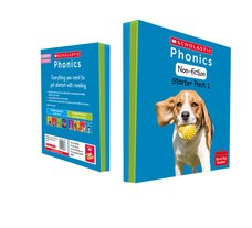
Phonics Book Bag Readers Non-fiction: Non-fiction Starter Pack 1
- usd prices
- Offer price: $49.15
- RRP: $49.16
- gbp prices
- Price: £31.92
- Not available to buy with Rewards
-
6books
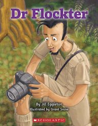
Connectors Purple: Dr Flockter x 6- usd prices
- Offer price: $60.05
- RRP: $60.06
- gbp prices
- Price: £39.00
- Not available to buy with Rewards
-
6books
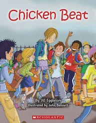
Connectors Purple: Chicken Beat x 6- usd prices
- Offer price: $60.05
- RRP: $60.06
- gbp prices
- Price: £39.00
- Not available to buy with Rewards
-
30copies
Philip's Junior Sch Atlas x30New
- usd prices
- Offer price: $352.95
- RRP: $415.34
- gbp prices
- Offer price: £229.20
- RRP: £269.70
-
6books
Connectors Purple: One More Time x 6- usd prices
- Offer price: $60.05
- RRP: $60.06
- gbp prices
- Price: £39.00
- Not available to buy with Rewards
-
6books
Connectors Purple: Rumbling Giants x 6- usd prices
- Offer price: $60.05
- RRP: $60.06
- gbp prices
- Price: £39.00
- Not available to buy with Rewards
-
Countries of the World
- usd prices
- Offer price: $6.95
- RRP: $7.68
- gbp prices
- Offer price: £4.50
- RRP: £4.99
-
Great Civilisations: The Maya
- usd prices
- Offer price: $12.45
- RRP: $13.84
- gbp prices
- Offer price: £8.10
- RRP: £8.99
-
6books
Bloomsbury Young Readers Pack- usd prices
- Offer price: $41.75
- RRP: $49.19
- gbp prices
- Offer price: £27.10
- RRP: £31.94
-
Puppy Called Sparkle
-
10books
Our Emotions And Behaviour Pack- usd prices
- Offer price: $100.70
- RRP: $118.43
- gbp prices
- Offer price: £65.40
- RRP: £76.90
-
Death Sets Sail
- usd prices
- Price: $11.50
- gbp prices
- Price: £7.50
-
Fast Finishers English: Non-fiction Ages 10-11
- usd prices
- Price: $46.20
- gbp prices
- Price: £30.00
-
Horrid Henry's Underpants
- usd prices
- Price: $7.50
- gbp prices
- Price: £5.00
-
6copies
Oxf Sch Dictionary PB 2023 x6- usd prices
- Offer price: $66.35
- RRP: $73.83
- gbp prices
- Offer price: £43.10
- RRP: £47.94
-
Murder Most Unladylike #8: Death in the Spotlight
- usd prices
- Price: $11.50
- gbp prices
- Price: £7.50
-
30copies
Oxford Primary Thesaurus x 30- usd prices
- Offer price: $313.70
- RRP: $369.14
- gbp prices
- Offer price: £203.70
- RRP: £239.70
-
5books
Horrid Henry ER Pack B- usd prices
- Price: $41.50
- gbp prices
- Price: £27.00
-
6copies
Philip's Junior Sch Atlas x6New
- usd prices
- Offer price: $74.70
- RRP: $83.07
- gbp prices
- Offer price: £48.50
- RRP: £53.94
-
6copies
Oxf Sch Thesaurus PB 2023 x6- usd prices
- Offer price: $66.35
- RRP: $73.83
- gbp prices
- Offer price: £43.10
- RRP: £47.94
-
The Story of Tracy Beaker
- usd prices
- Price: $11.50
- gbp prices
- Price: £7.50
-
Project X: Level 9 Communication Pack (Book Band Gold)
- usd prices
- Offer price: $46.95
- RRP: $55.26
- gbp prices
- Offer price: £30.50
- RRP: £35.88
-
30copies
Oxford Primary Dictionary x30- usd prices
- Offer price: $313.70
- RRP: $369.14
- gbp prices
- Offer price: £203.70
- RRP: £239.70
-
Project X: Level 8 Habitat Pack (Book Band Purple)
- usd prices
- Offer price: $46.95
- RRP: $55.26
- gbp prices
- Offer price: £30.50
- RRP: £35.88


