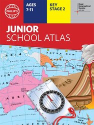
Philip's Junior School Atlas x 30 Pack
30copies

- Format
- Paperback
- usd prices
- Price: $373.80 Switch to £
- gbp prices
- Price: £242.73 Switch to $
Buy this and your school gets $74.76 to spend on books
This product has not been rated yet.
0 reviews (Add a review)

Delivery information
We are only able to deliver orders to school addresses
- FREE delivery for schools*
- Delivery within 10 working days
Book Club orders
- FREE delivery to schools
- Books will be despatched after the school's order is confirmed
*We do not charge for delivery, but your order may incur additional customs costs.
Product description
Maybe you’ve looked at a globe and been amazed by the sight of all the world’s countries. But did you know that maps can show you much more than just where places are? Landscape, population, industries, transport, tourism: maps can illustrate all these things. Clever, huh? Now this handy book shows you a huge range of maps, giving you all the skills you need to read them. Take a close-up look at the UK and Ireland. What cool stuff is right on your doorstep? Then check out all your must-see global destinations. The maps in here will be your guide…
- The market-leading atlas for National Curriculum KS2
- Clearly explains different map types, scale and symbols
- Covers topics including climate, industry, transport and energy
- 22-page section for the UK and Ireland, including regional maps
- Political and physical maps, plus an overview of each continent
- Published in association with the Royal Geographical Society
Supplied as a pack of 30 copies.
Product Details
Catalogue number
3074 in Schools Catalogue 2024–25
Format
Paperback
Date published
June 6th, 2019
Condition
New
UK editionIn this pack
-
 Philip's RGS Junior School Atlas
- usd prices
- Price: $12.45
- gbp prices
- Price: £8.10
Reviews
This product has not been reviewed yet.
Add a review
Similar items
-
30copies
Philip's Infant School Atlas x 30- usd prices
- Price: $373.80
- gbp prices
- Price: £242.73
-
6copies
Philip's Junior School Atlas x 6- usd prices
- Price: $74.75
- gbp prices
- Price: £48.55
-
6copies
Collins Primary Atlas x 6- usd prices
- Price: $66.45
- gbp prices
- Price: £43.15
-
6copies
Philip's Infant School Atlas x 6- usd prices
- Price: $74.75
- gbp prices
- Price: £48.55
-
30copies
Collins Primary Atlas x 30- usd prices
- Price: $332.20
- gbp prices
- Price: £215.73
-
Collins First Atlas
- usd prices
- Price: $8.30
- gbp prices
- Price: £5.40
-
Philip's RGS Infant School Atlas
- usd prices
- Price: $12.45
- gbp prices
- Price: £8.10
-
30copies
Oxford Primary Thesaurus x 30- usd prices
- Price: $332.20
- gbp prices
- Price: £215.73
-
6copies
Oxford Primary Thesaurus x 6- usd prices
- Price: $66.45
- gbp prices
- Price: £43.15
-
Barrington Stoke School Spelling Dictionary
- usd prices
- Price: $18.00
- gbp prices
- Price: £11.70
-
Collins School Dictionary
- usd prices
- Price: $11.10
- gbp prices
- Price: £7.20
-
Oxford Primary Illustrated Maths Dictionary
- usd prices
- Price: $13.85
- gbp prices
- Price: £9.00


Customers also bought
-
30copies
Philip's Infant School Atlas x 30- usd prices
- Price: $373.80
- gbp prices
- Price: £242.73
-
6copies
Philip's Infant School Atlas x 6- usd prices
- Price: $74.75
- gbp prices
- Price: £48.55
-
Beware! Killer Tomatoes
Award-winning
-
6copies
Barrington Stoke Fiction: A Dangerous Game x6- usd prices
- Price: $64.59
- gbp prices
- Price: £41.94
-
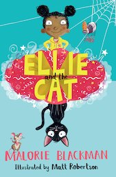
6copies
Ellie & the Cat x6- usd prices
- Price: $73.83
- gbp prices
- Price: £47.94
-
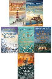
6books
Emma Carroll Pack x6- usd prices
- Price: $62.75
- gbp prices
- Price: £40.75
-
169-Storey Treehouse
-
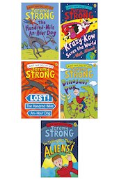
7books
Jeremy Strong Pack- usd prices
- Price: $54.90
- gbp prices
- Price: £35.64
-
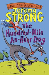
6copies
The Hundred-Mile-An-Hour Dog x 6Award-winning team
- usd prices
- Price: $64.59
- gbp prices
- Price: £41.94
-
Marvel: Spider-Ham: Spider-Ham Hollywood May-Ham!
- usd prices
- Price: $11.40
- gbp prices
- Price: £7.40
-
Sparks #2: Double Dog Dare: A Graphic Novel (Sparks! #2)
- usd prices
- Price: $13.85
- gbp prices
- Price: £9.00
-
Sparks #1: Sparks! A Graphic Novel
- usd prices
- Price: $13.85
- gbp prices
- Price: £9.00
-
6copies
Letters from the Lighthouse x 6- usd prices
- Price: $73.83
- gbp prices
- Price: £47.94
-
Secrets of a Sun King
- usd prices
- Price: $11.10
- gbp prices
- Price: £7.20
-
The Week at World's End
Award-winning author
- usd prices
- Price: $12.30
- gbp prices
- Price: £7.99
-
Quick, Let's Get Out of Here
Award-winning team
- usd prices
- Price: $10.76
- gbp prices
- Price: £6.99
-
Overheard in a Tower Block
Award-winning author
- usd prices
- Price: $11.10
- gbp prices
- Price: £7.20
-
The Works: Key Stage 2
- usd prices
- Price: $13.84
- gbp prices
- Price: £8.99
-
This Book Is Anti-Racist
- usd prices
- Price: $12.45
- gbp prices
- Price: £8.10
-
The Story of Slavery
- usd prices
- Price: $8.30
- gbp prices
- Price: £5.40
-
6books
Earth's Natural Biomes Pack- usd prices
- Price: $70.60
- gbp prices
- Price: £45.85
-
Crookhaven
- usd prices
- Price: $11.40
- gbp prices
- Price: £7.40
-
I Don't Like Poetry
- usd prices
- Price: $9.70
- gbp prices
- Price: £6.30
-
3books
Bad Food Graphic Novels Pack x 3- usd prices
- Price: $29.05
- gbp prices
- Price: £18.85
-
4books
Pie Corbett's Poetry Spine: Year 5 Pack x 4- usd prices
- Price: $46.14
- gbp prices
- Price: £29.96
-
The Dragon Prince: Puzzle House (The Dragon Prince Graphic Novel #3)
- usd prices
- Price: $11.40
- gbp prices
- Price: £7.40
-
5books
Malorie Blackman Ages 7-9 PackAward-winning author
- usd prices
- Price: $44.45
- gbp prices
- Price: £28.86
-
The Works: Key Stage 1
- usd prices
- Price: $13.84
- gbp prices
- Price: £8.99
-
Wings of Fire #6: Moon Rising (Wings of Fire Graphic Novel #6)
- usd prices
- Price: $15.25
- gbp prices
- Price: £9.90
-
The Girl Who Speaks Bear
- usd prices
- Price: $11.40
- gbp prices
- Price: £7.40


