Philip's Infant School Atlas

This product is not currently available.
To help you find what you're looking for, see similar items below.
Rated 4/5 from 1 rating
0 reviews (Add a review)

Delivery information
We are only able to deliver orders to school addresses
- FREE delivery for schools*
- Delivery within 10 working days
Book Club orders
- FREE delivery to schools
- Books will be despatched after the school's order is confirmed
*We do not charge for delivery, but your order may incur additional customs costs.
Product description
Philip’s best-selling atlas for 5 to 7-year olds is ideal for teaching Key Stage 1, helping to cover geography, history, science, citizenship and literacy requirements
- Written by experts Professor David Wright and Rachel Noonan - Published in association with the Royal Geographical Society - 50 pages of clear, child-friendly maps showing our world today - Countries brought to life with flags, illustrations and photos - Bold text, simple words and short sentences to encourage reading skills - Starts with the Earth as a Planet then zooms into each of the world’s regions with maps and illustrations - Numbered balloons on each map link to photos of real place
Fully revised and updated, the new edition Philip’s Infant School Atlas is intended for children in the early stages of reading, aged between 5 and 7 years old, with simple text to explain what is happening on the maps and illustrations to the young children. The atlas contents have been designed to be compatible with National Curriculum Key Stage 1 expectations.
Clear, child-friendly maps are combined with fascinating photographs and facts about the world to provide essential geographical information for young children. ‘Balloons’ link photos of real places to each map. Guidance is given at the beginning of the atlas on how to use the maps, encouraging the early development of map skills and knowledge of the world. An index to the maps plus an illustrated glossary complete the atlas.
Each colourful spread is illustrated with fascinating colour photographs and packed with fact boxes, curiosities, flags, stamps and simple quiz questions. Philip’s Infant School Atlas is both fun to use and easy to understand. The text is simple and uncomplicated, and will encourage early reading skills to develop in the children.
Product Details
Format
Paperback
ISBN
9781849074896
Date published
June 6th, 2019
Other details
- 48 pages
Condition
New
UK editionReviews
This product has not been reviewed yet.
Add a review
Similar items
-

6copies
Collins First Atlas x 6- usd prices
- Price: $49.80
- gbp prices
- Price: £32.35
-
30copies
Collins First Atlas x 30- usd prices
- Price: $249.05
- gbp prices
- Price: £161.73
-
Philip's RGS Infant School Atlas
- usd prices
- Price: $12.45
- gbp prices
- Price: £8.10
-
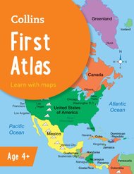
Collins First Atlas
- usd prices
- Price: $8.30
- gbp prices
- Price: £5.40
-
6copies
Philip's Infant School Atlas x 6- usd prices
- Price: $74.75
- gbp prices
- Price: £48.55
-
6copies
Collins Primary Atlas x 6- usd prices
- Price: $66.45
- gbp prices
- Price: £43.15
-
30copies
Philip's Infant School Atlas x 30- usd prices
- Price: $373.80
- gbp prices
- Price: £242.73
-
Barrington Stoke School Spelling Dictionary
- usd prices
- Price: $18.00
- gbp prices
- Price: £11.70
-
30copies
Collins Primary Atlas x 30- usd prices
- Price: $332.20
- gbp prices
- Price: £215.73
-
30copies
Philip's Junior School Atlas x 30- usd prices
- Price: $373.80
- gbp prices
- Price: £242.73
-
6copies
Philip's Junior School Atlas x 6- usd prices
- Price: $74.75
- gbp prices
- Price: £48.55
-
Lift-the-Flap Looking After Our Planet
- usd prices
- Price: $13.85
- gbp prices
- Price: £9.00


