Collins Primary Atlas
This product is not currently available.
To help you find what you're looking for, see similar items below.
This product has not been rated yet.
0 reviews (Add a review)

Delivery information
We are only able to deliver orders to school addresses
- FREE delivery for schools*
- Delivery within 10 working days
Book Club orders
- FREE delivery to schools
- Books will be despatched after the school's order is confirmed
*We do not charge for delivery, but your order may incur additional customs costs.
Product description
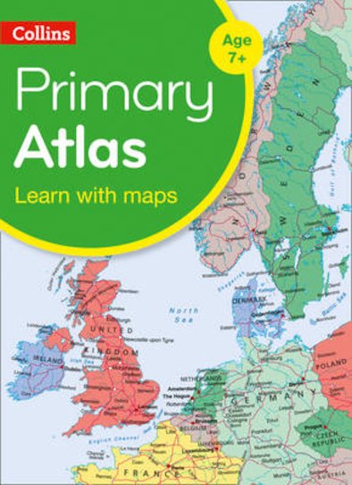
Bag the perfect KS2 Atlas this Back to School A curriculum-supportive Primary Atlas for children aged 7-11 years (Key Stage 2). Designed for use in the classroom or at home, this revised edition includes informative politically coloured reference mapping of all major world regions and relevant topics.
This primary atlas provides an introduction to mapping of the UK, Europe and all major regions of the world. It includes information on map reading skills, the meaning of scale and measuring distances. The reference maps are informative, politically coloured, and easy to read with national capitals and major cities easily identifiable. The maps are supported with national flags and basic national statistics. Continental maps are linked to the regional mapping and are supported by a selection of aerial and terrestrial photographs. Continental relief maps show layer colouring and major physical features are highlighted.
Product Details
Format
Paperback
ISBN
9780008319458
Date published
January 3rd, 2019
Other details
- 68 pages
Condition
New
UK editionReviews
This product has not been reviewed yet.
Add a review
Similar items
-
 Philip's RGS Infant School Atlas
- usd prices
- Price: $12.45
- gbp prices
- Price: £8.10
-
30copies
Philip's Junior School Atlas x 30- usd prices
- Price: $373.80
- gbp prices
- Price: £242.73
-
6copies
Collins Primary Atlas x 6- usd prices
- Price: $66.45
- gbp prices
- Price: £43.15
-
30copies
Philip's Infant School Atlas x 30- usd prices
- Price: $373.80
- gbp prices
- Price: £242.73
-
6copies
Philip's Junior School Atlas x 6- usd prices
- Price: $74.75
- gbp prices
- Price: £48.55
-
6copies
Philip's Infant School Atlas x 6- usd prices
- Price: $74.75
- gbp prices
- Price: £48.55
-
30copies
Collins Primary Atlas x 30- usd prices
- Price: $332.20
- gbp prices
- Price: £215.73
-
Lift-the-flap Questions and Answers about Our World
New
- usd prices
- Price: $13.85
- gbp prices
- Price: £9.00
-
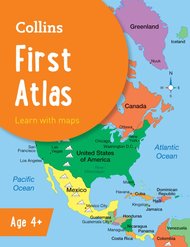
Collins First Atlas
- usd prices
- Price: $8.30
- gbp prices
- Price: £5.40
-
Stranger Places
- usd prices
- Price: $11.40
- gbp prices
- Price: £7.40
-
6copies
Connectors Ages 10+: Far-Flung Places x 6- usd prices
- Price: $60.06
- gbp prices
- Price: £39.00
-
6books
Connectors Ages 11+: Human Barriers - The Walls of the World x 6- usd prices
- Price: $60.06
- gbp prices
- Price: £39.00


