Philip's Junior School Atlas

This product is not currently available.
To help you find what you're looking for, see similar items below.
This product has not been rated yet.
0 reviews (Add a review)

Delivery information
We are only able to deliver orders to school addresses
- FREE delivery for schools*
- Delivery within 10 working days
Book Club orders
- FREE delivery to schools
- Books will be despatched after the school's order is confirmed
*We do not charge for delivery, but your order may incur additional customs costs.
Product description
The market-leading atlas for pupils at primary schools, Philip’s Junior School Atlas has been fully revised for its 9th edition. It is a stimulating and authoritative first introduction to the world of maps, and is recommended for Key Stage 2 of the National Curriculum.
The introductory section describes the meaning of scale, how to measure distances using the maps, and explains the symbols on the maps.
The following section is devoted to the United Kingdom and Ireland. Thematic maps cover topics such as mountains and rivers, climate and weather, population and cities, farming and fishing, industry and energy, transport, tourism and conservation. Regional maps of England and Wales, Scotland and Ireland complete this section.
The rest of the atlas is made up of world thematic maps and world continental maps. Included are topics such as the world’s climate, vegetation, agriculture, energy sources, and environmental concerns, such as global warming.
A simple letter-figure index completes the atlas – a useful introduction to help the young reader find his/her way around the maps.
Product Details
Format
Paperback
ISBN
9781849073981
Publisher
Date published
November 5th, 2015
Other details
- 64 pages
Condition
New
UK editionReviews
This product has not been reviewed yet.
Add a review
Similar items
-
 Philip's RGS Infant School Atlas
- usd prices
- Price: $12.45
- gbp prices
- Price: £8.10
-
6copies
Collins Primary Atlas x 6- usd prices
- Price: $66.45
- gbp prices
- Price: £43.15
-
30copies
Collins Primary Atlas x 30- usd prices
- Price: $332.20
- gbp prices
- Price: £215.73
-
30copies
Philip's Junior School Atlas x 30- usd prices
- Price: $373.80
- gbp prices
- Price: £242.73
-
30copies
Philip's Infant School Atlas x 30- usd prices
- Price: $373.80
- gbp prices
- Price: £242.73
-
6copies
Philip's Infant School Atlas x 6- usd prices
- Price: $74.75
- gbp prices
- Price: £48.55
-
6copies
Philip's Junior School Atlas x 6- usd prices
- Price: $74.75
- gbp prices
- Price: £48.55
-
Lift-the-flap Questions and Answers about Our World
New
- usd prices
- Price: $13.85
- gbp prices
- Price: £9.00
-
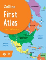
Collins First Atlas
- usd prices
- Price: $8.30
- gbp prices
- Price: £5.40
-
Stranger Places
- usd prices
- Price: $11.40
- gbp prices
- Price: £7.40
-
6books
Connectors Ages 10+: The Right to Survive x 6- usd prices
- Price: $60.06
- gbp prices
- Price: £39.00
-
6copies
Silence is Not an Option x6- usd prices
- Price: $83.07
- gbp prices
- Price: £53.94


